GWD Bio-intelligence
GWD-SURVEY01 Commercial Topographic Detector Dslr Drone Obstacle Avoidance Mapping GPS Waypoints Surveying Mapping Drones With Camera Custom
GWD-SURVEY01 Commercial Topographic Detector Dslr Drone Obstacle Avoidance Mapping GPS Waypoints Surveying Mapping Drones With Camera Custom
Regular price
$21,999.00
Regular price
$36,870.00
Sale price
$21,999.00
Unit price
per
Couldn't load pickup availability
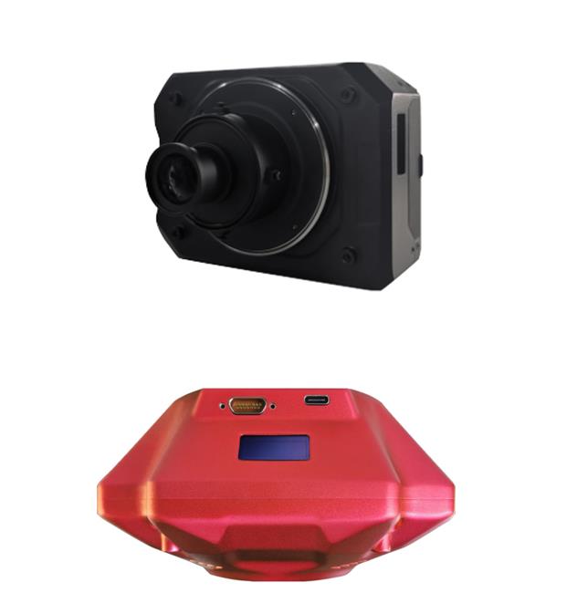
Products Description
|
Model Number
|
GWD-SURVEY01
|
|
Name
|
drone camera 4k hd
|
|
Pixel
|
4K
|
|
Power
|
Battery
|
|
Battery
|
7.7V 1820mAh
|
|
Control Type
|
Remote Control
|
|
Fold Size
|
140*190*50mm
|
|
Unfold Size
|
310*270*56mm
|
|
Remote Control Distance
|
About 600 meters
|
|
Flight time
|
22 Minutes
|
|
Flight System
|
GPS/ barometric pressure
|
|
Camera Parameters
|
3840x2160
|
|
Charging Time
|
2.5h, type-c
|
|
Image Transmission Signal
|
5G anti-interference
|
|
Packing
|
Single box: 255x80x225mm, Storage bag: 255x80x230mm
|
|
Colour
|
Gray
|
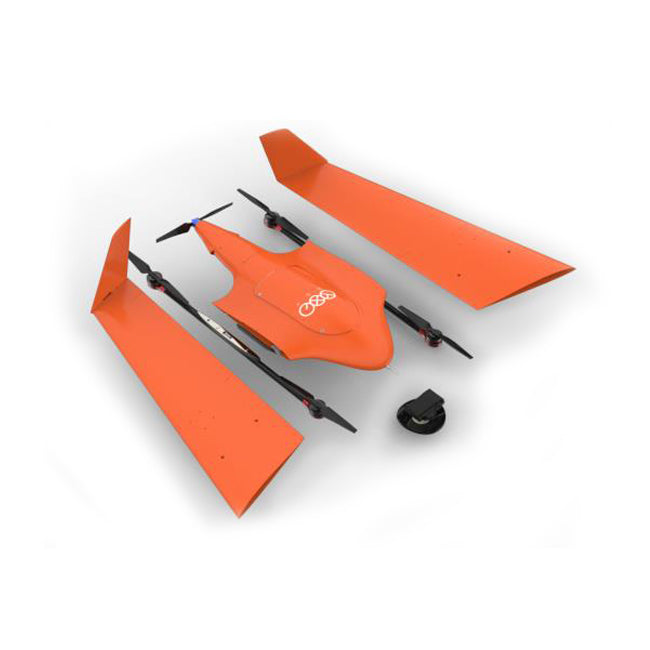
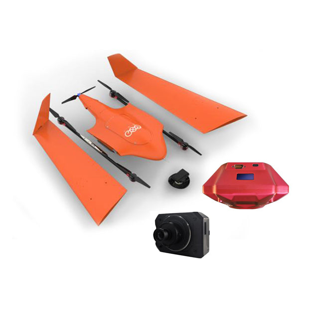
Commercial Topographic Detector Dslr Drone Obstacle Avoidance Mapping GPS Surveying Mapping Drones With Camera Custom


Uav positioning system is widely used in all walks of life. Suitable for large area topographic survey (fire, highway, railway, water conservancy, search and rescue, etc., suitable for all kinds of scale map), electric power inspection or electric power site selection, surveying units, public sector institutions. The takeoff weight of uav is 10.8kg, the standard load is 1-2kg, and the endurance time is 120 minutes. The whole machine is modular design, with hardware functions such as trunk transportation. The data collected covers an area of 30 square kilometers (topographic relief no more than 300 meters, 1:1000 scale), with high precision and reduced risk of work. All products can be customized, welcome to contact us.